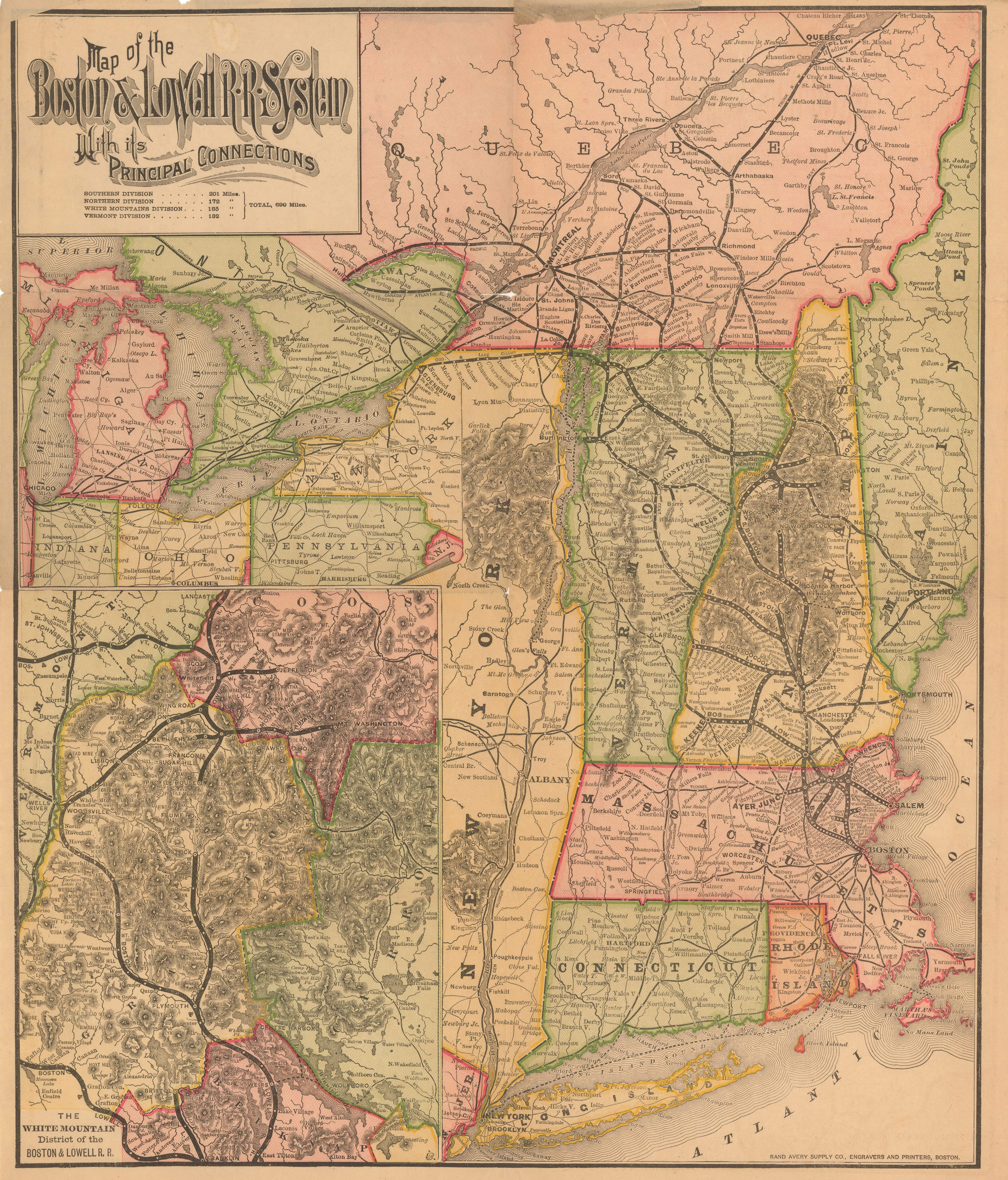
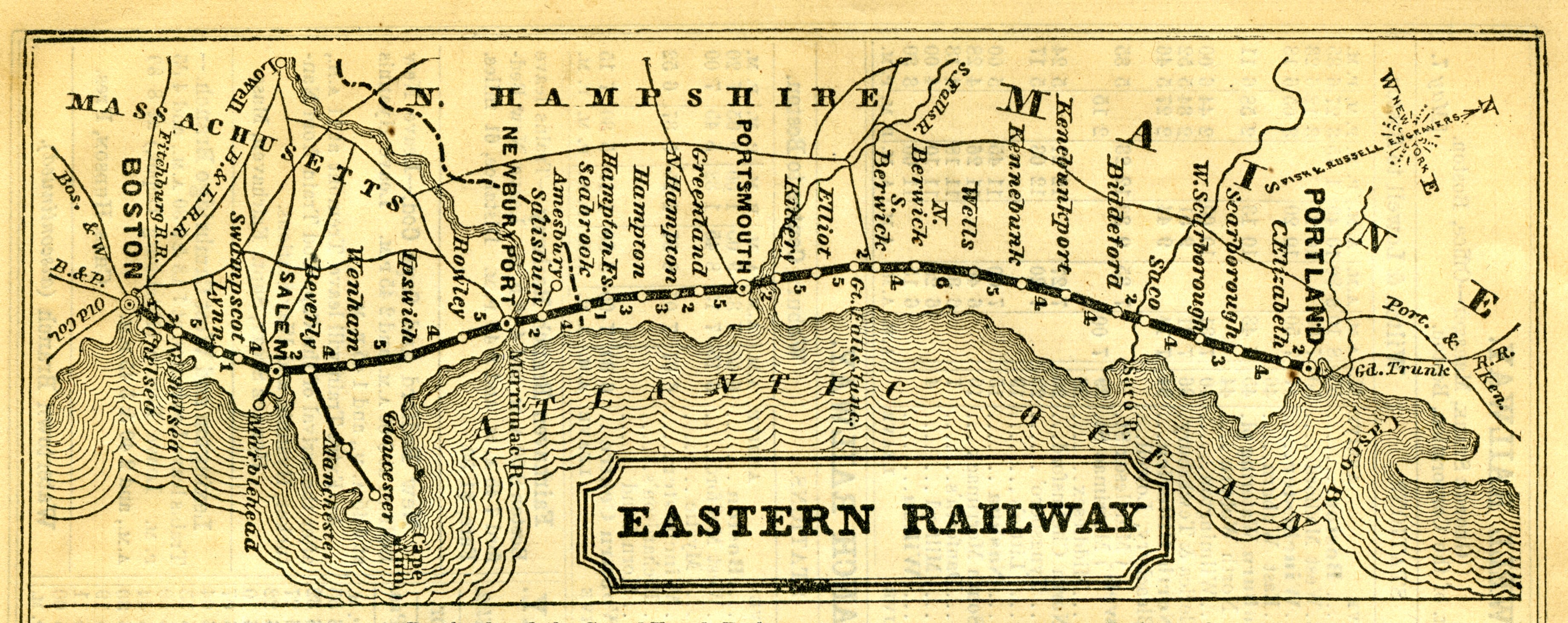
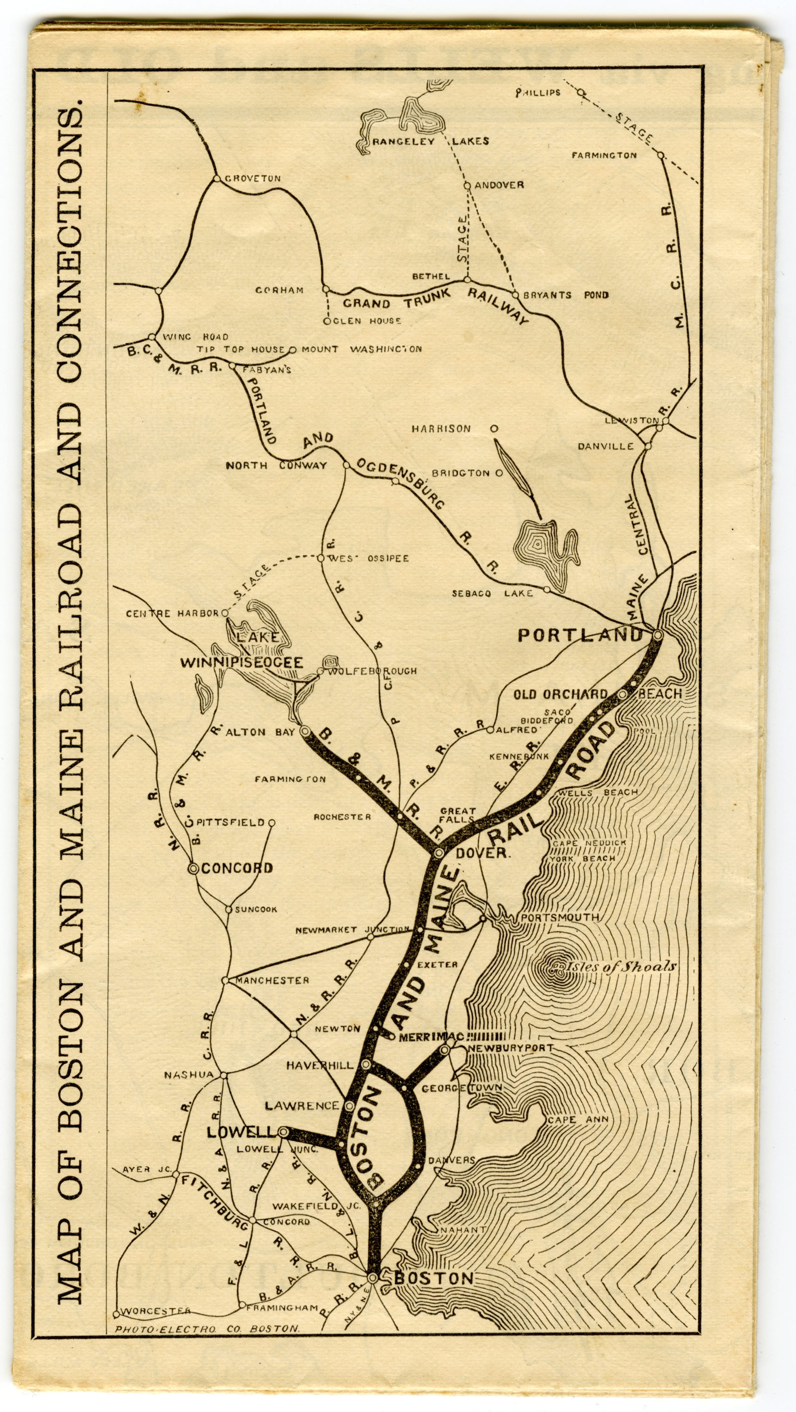
Today’s MBTA commuter rail network is built on the legacy of eight nineteenth-century railroad companies. The Boston & Lowell VC3.1 ran from Boston, through the Merrimack Valley and into northern New England. The Eastern VC3.3 linked Boston and Portland, Maine. The Fitchburg {{VC3.4}} served northern Massachusetts and, via the Hoosac Tunnel beneath the Berkshires, communities westward. The Boston & Maine’s nascent network VC3.2 paralleled much of the Eastern’s. The Old Colony’s simple Boston to Plymouth line sprouted branches sprawling throughout southeastern Massachusetts. VC3.6 The Boston & Providence and Boston & New York Central were established to link their namesake cities.
VC3.1
Boston & Lowell Railroad System Map
Boston & Lowell Railroad
1886
WardMaps LLC
VC3.4
Fitchburg Railroad Timetable Map
Fitchburg Railroad
1898
WardMaps LLC

Through leases and mergers, and sometimes after bankruptcies and purchases, by 1900 Boston’s eight railroads were effectively consolidated into three: the Boston & Maine, the Boston & Albany, VC3.5 and the New Haven. VC3.7 Correspondingly, railroads consolidated Boston’s seven passenger terminals into two, North Station and South Station. The Boston & Albany and New Haven paired up to create the Boston Terminal Company and with it, South Station. A detailed plan VC3.8 prepared by the Boston Terminal Company reveals the sprawling trackage and facilities of South Station, the largest train station ever constructed in New England.
VC3.5
[Map of the Railroads of Massachusetts Running West From Boston]
Ephraim W. Bouvé
1840s
Leventhal Map & Education Center
![Image of [Map of the Railroads of Massachusetts Running West From Boston]](https://iiif.digitalcommonwealth.org/iiif/2/commonwealth:x059cc84w/full/,800/0/default.jpg)
VC3.7
The New York, New Haven & Hartford Railroad and Connections
Rand Avery Supply Co.
1894
Leventhal Map & Education Center

VC3.8
General Plan of Terminal Station at Boston, Massachusetts, for the N.Y. N.H. & H. and B. & A. Railroads
Boston Terminal Co.
1899
WardMaps LLC
