Franklin Park Adventure: Taking the Bus
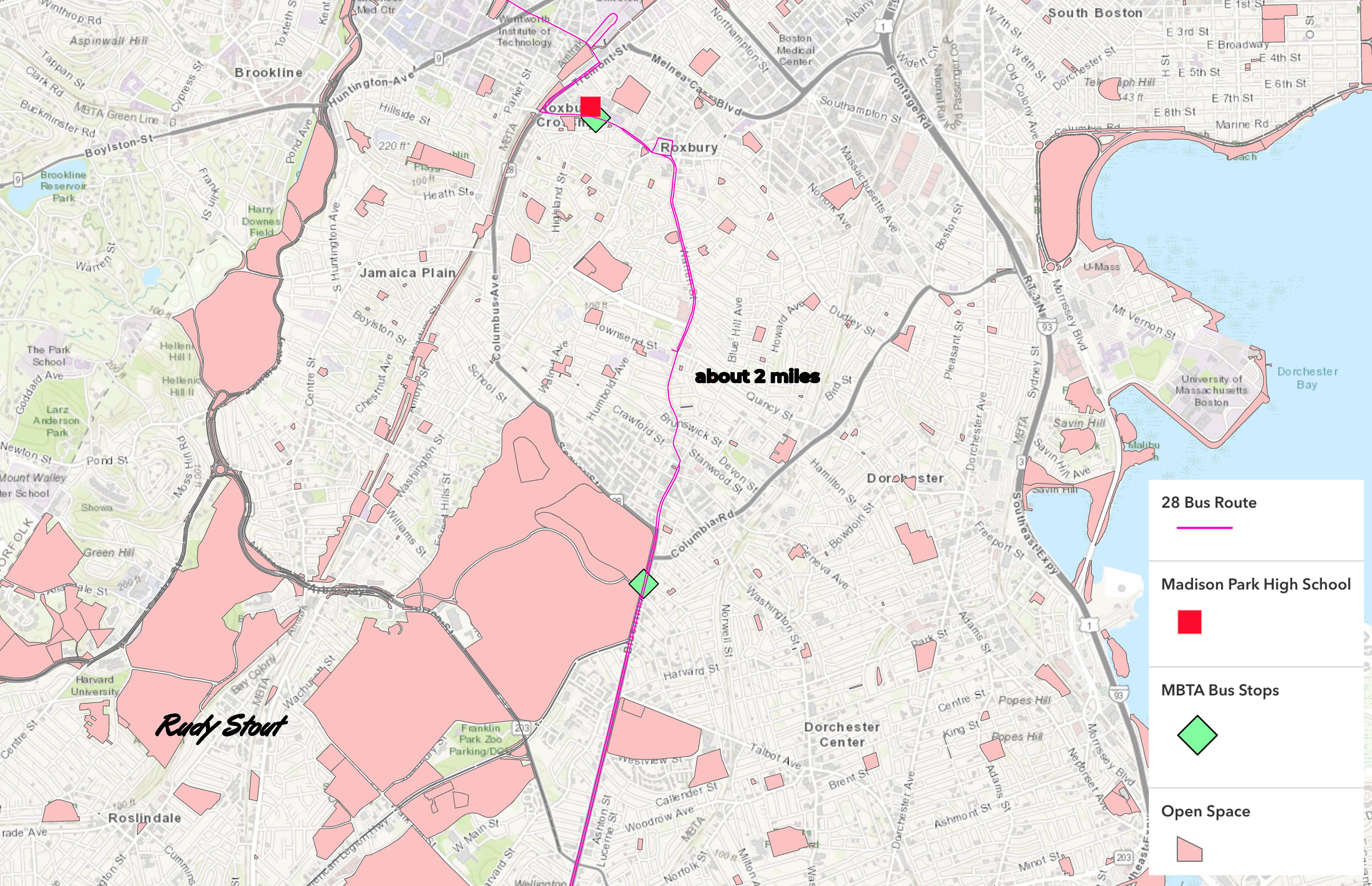
This is a map that I made that lets people know how to get to the Franklin Park Zoo from Madison Park high school on a 28 MBTA bus. Some layers of data you can see are bus stops, bus routes, Boston Public Schools and an add-on measuring tool. Two symbols I have on my map are diamond waypoints that show two stops that the 28 goes to.
Steps we had to do to get here is we had to do our research on the different stops so we could know what type of layers we needed. So when we did that, we removed all bus stops we did not want, and also all the BPS schools we didn’t need. The hardest step we struggled with was trying to find the right 28 stops. Then I figured out the distance to the school and Franklin Park was about two miles on a bus.
One view I want people to see when they look at my map is that the map is good for students and teachers who go to Madison Park to go and take a trip, maybe check out the zoo with family or friends, or maybe walk the park on a nice sunny day with their friends, or maybe go test a new hobby like golf at the golf club.

