
November 12, 2024


What’s Going On In the Gallery? — Education Nooks
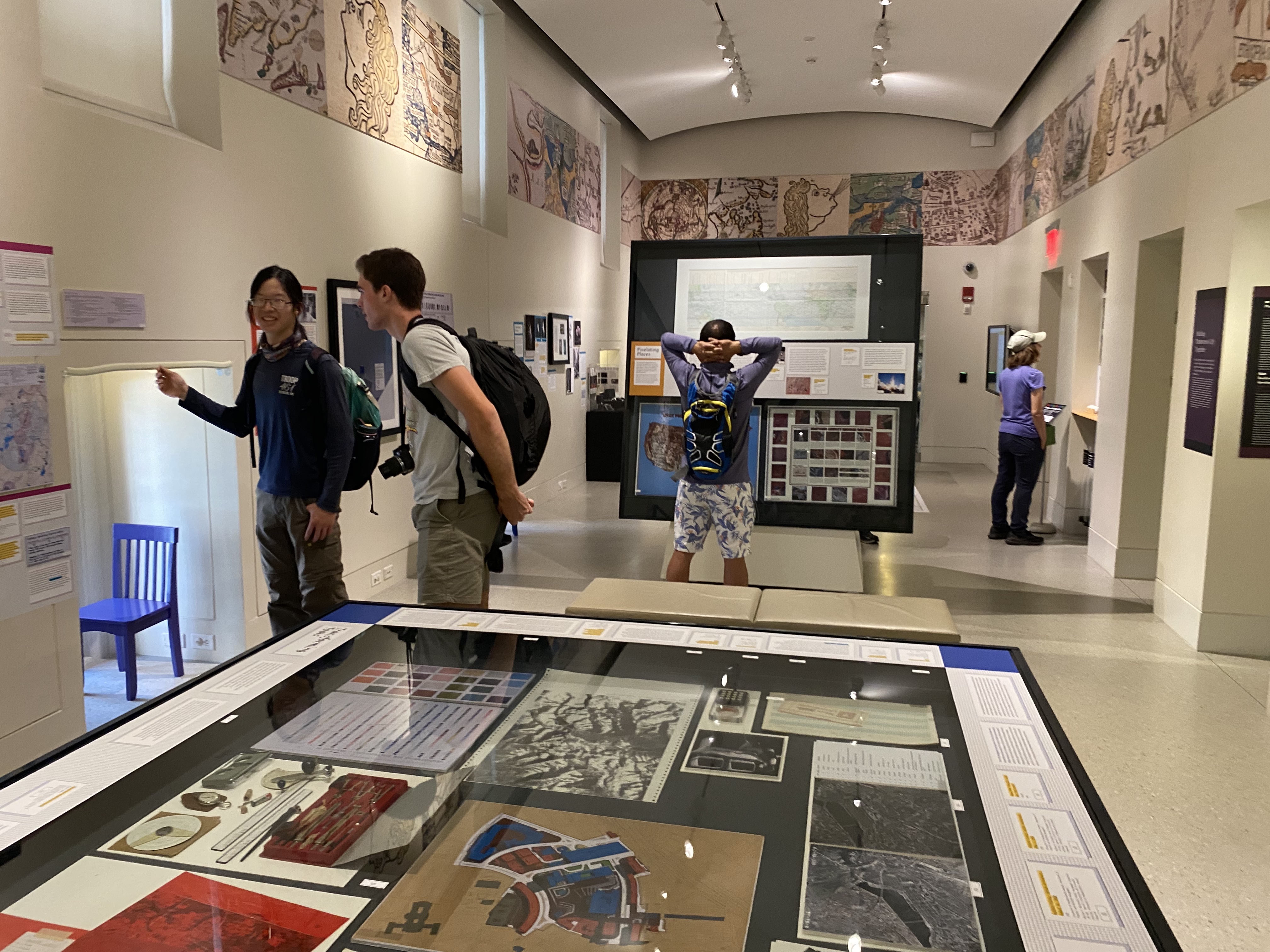
Exhibitions at the Leventhal Center are always evolving to offer new entry points into geographic themes for all of our visitors, no matter their age. Newly featured in the gallery as an accompaniment to the current exhibit Processing Place are four child-centered activities that explore different aspects of computer cartography. With activities on map layers, categorizing pixels, matching key words, and children’s literature on mapmaking, you’ll find many different opportunities to try your hand at the elements of computer cartography. Be sure to check out the nooks on your next visit to the gallery!
Call for Spring 2025 Interns
Applications are now open for our Spring 2025 cohort of undergraduate interns. Our internship program trains the next generation of professionals in topics related to geospatial technology, public humanities, and librarianship. Interns will work onsite in the Center’s offices at the Central Library for 6-10 hours per week from mid-January 2025 through early May 2025 focused on Geohumanities & GIS. Apply online by November 22, 2024 at 3:00 pm ET.

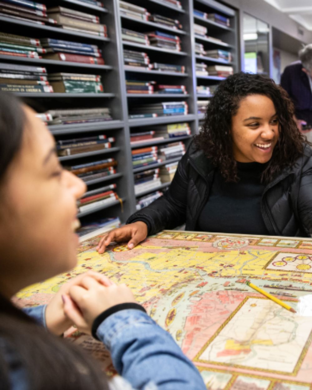
Walk to the Sea: New Essays
We’re excited to announce a new set of digital companion essays that add interpretive depth to the Norman B. Leventhal Walk to the Sea. This one-mile walk from Beacon Hill to Long Wharf invites you into the history of a city whose destiny and fortunes have long been shaped by the relationship between land and water.
These digital essays were written by Northeastern University students for the course Practicum on the Place-Based Museum, taught at the Leventhal Center. From Beacon Hill and its impact on Boston’s rapid growth as a city to the Long Wharf and its role as a cultural and recreational asset, the stories highlighted in these essays prompt deeper thinking about this ever-evolving city.

2024 Druker Award & Lecture: Ted Landsmark · November 16, 2 pm ET
The Druker Award is presented annually to a speaker or speakers who has or have made outstanding and important contributions to the world of design. This year’s awardee is Theodore (Ted) C. Landsmark, a civic planner, educator, civil rights advocate, and member of the Leventhal Center’s Board of Directors. In conversation with BPL President David Leonard, Landsmark will reflect on reimagining the urban public library, transformative civic spaces, and building an equitable city. There will be an audience Q&A following the discussion. Druker Company President Ronald M. Druker will give welcoming remarks.
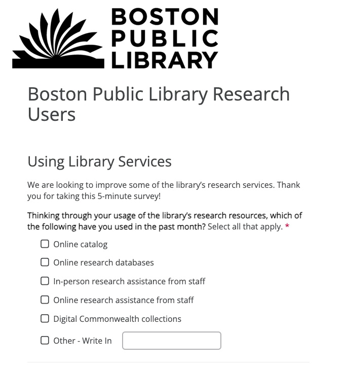
Help Improve BPL Digital Research Resources
Do you use BPL research resources? On behalf of our Boston Public Library Digital Services colleagues, we’re helping to distribute a survey that will help inform decisions around future development of these resources. The survey is intended for you to tell the Digital Services team a bit about how you use the BPL research databases, catalogs, and resources and to sign up for a short interview to help improve your experience.
Upcoming Holiday Hours
For the upcoming Thanksgiving holiday, the LMEC gallery will be closed on Wednesday, November 27 and Thursday, November 28. For all upcoming schedule gallery closures, please check our website.
Newsletter Trivia: The Boston Neck
It’s time to test your map and history knowledge to win a chance of receiving three free months in our Map Of The Month Club. In order to enter, make sure you follow us on Instagram or Facebook and either direct message or email us the answer to the following question. We’ll accept answers until November 18 at 9 am ET. Correct answers will be included in a random draw—the winner will receive the next three Map of the Month club postcards for free. Congratulations to our last winner, Ron!
Before landfilling, the town of Boston was originally constrained in the Shawmut Peninsula, which was connected to the mainland by just a single road. Located on the “Boston Neck”, this road would eventually be named Washington Street, which is what we call it today. Sometimes referred to as “South End Road,” what was the original name of this street prior to the American Revolution?
- Eliot Street
- Shawmut Avenue
- Orange Street
- Belchers Land Road
The answer to the last Newsletter Trivia question about what candy is still being made in the former candy making capital of Cambridge, MA is Junior Mints.
The Leventhal Map & Education Center is an independent nonprofit. We rely on the contributions of donors like you to support our mission of preserving the past and advancing the future of maps and geography.
View this email in your browser
Leventhal Map & Education Center at the Boston Public Library
617.859.2387 · info@leventhalmap.org
{{SenderInfoLine}}