
June 21, 2022


"At 200, Frederick Law Olmsted continues to shape public space"
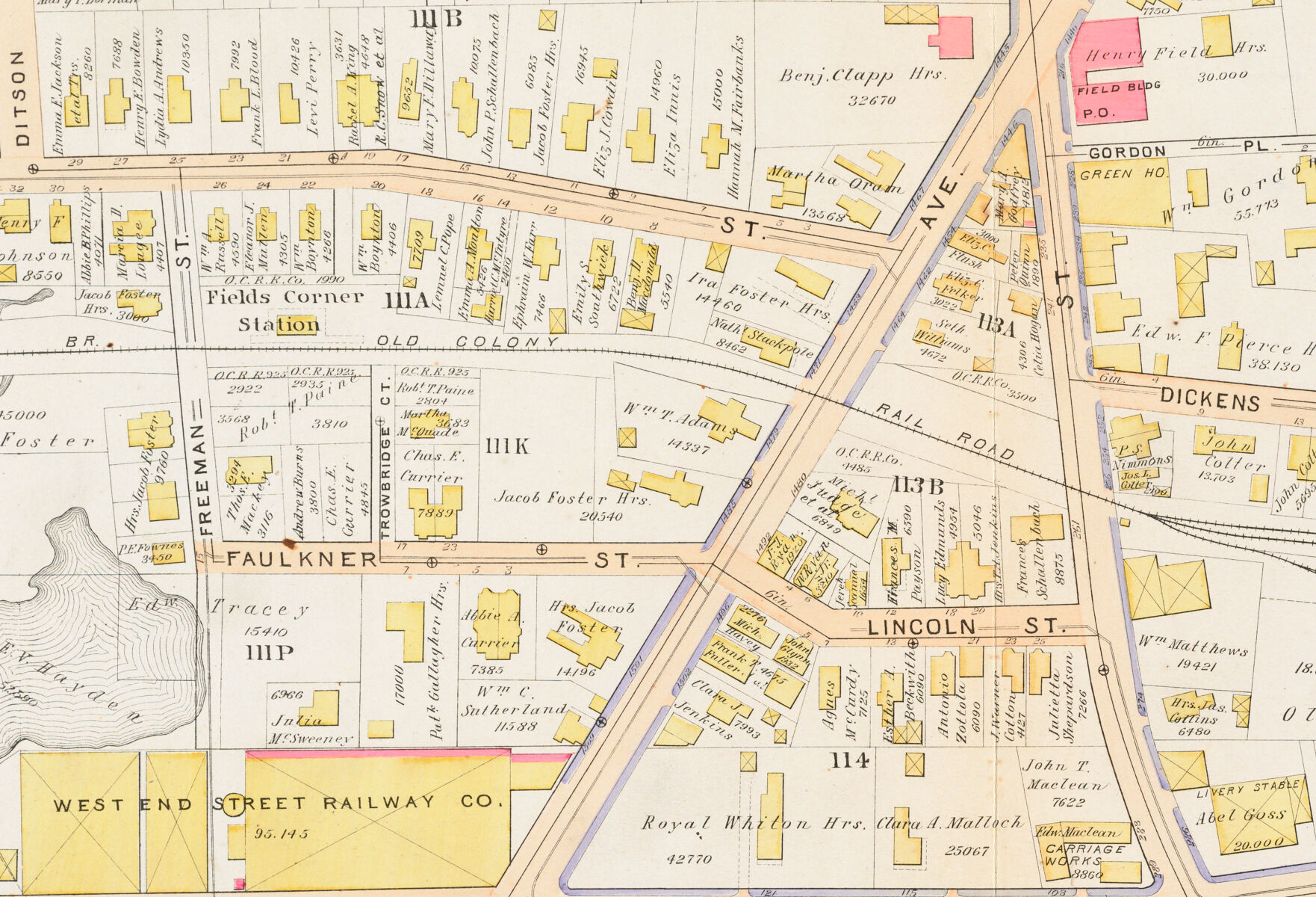
What would it mean to “complete” the Emerald Necklace? A recent cover story from the Boston Globe examined the life and legacy of Frederick Law Olmsted and contemporary challenges to his landscape vision for Boston, featuring insights from our environmental justice exhibition. We’d also recommend the accompanying map feature and quiz to test your Olmsted knowledge. (And if you’re feeling good about your trivia skills, we’ve got an event for you on June 23.)

Olmsted Trivia is this week! · June 23, 6pm ET
Join LMEC, the Frederick Law Olmsted National Historic Site, and Friends of Fairsted for four rounds of trivia on Olmsted and Boston landscapes on Thursday, June 23 at 6pm at the Central Library’s Newsfeed Café. Bring your friends and compete for map-related prizes (and geographic bragging rights). We’ll have questions featuring a historical scavenger hunt with Atlascope and more traditional trivia testing your knowledge of Olmsted and his infamous parks. Drinks and food will be available for purchase.
LMEC awarded Library of Congress Regional Grant
This Library of Congress Teaching with Primary Sources (TPS) Regional Grant will support our 2023 exhibition Building Up: Community Stories from the Urban Atlases Collection. Materials produced as part of this grant will join our existing collection of Tools for Teachers available digitally.
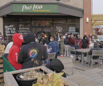
"Some really special people came to our classroom"
Earlier this year, students at the Lilla G. Frederick Pilot Middle School explored their neighborhoods and interviewed business owners, artists, and residents with the support of Boston Preservation Alliance and our K-12 Education team. We loved seeing this video of what the students learned using Atlascope for their research, and we were especially touched by the students' kind words.
Want more GIS in your life (and inbox)?
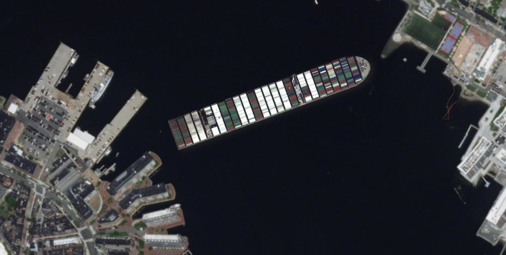
Every once in a while, we really like to talk shop about maps, data, and digital cartography. This recent interview with Bert Spaan about our support of his open-source georeferencing tool Allmaps is just one example of how much we love to open the hood of our geospatial systems. For the most part, we try to keep technical jargon out of our website and newsletter, but we’re looking for people who might appreciate the inner mechanics of our digital tools, mapmaking, and general tinkering. If that sounds interesting, why not sign up for our brand-new monthly GIS newsletter?
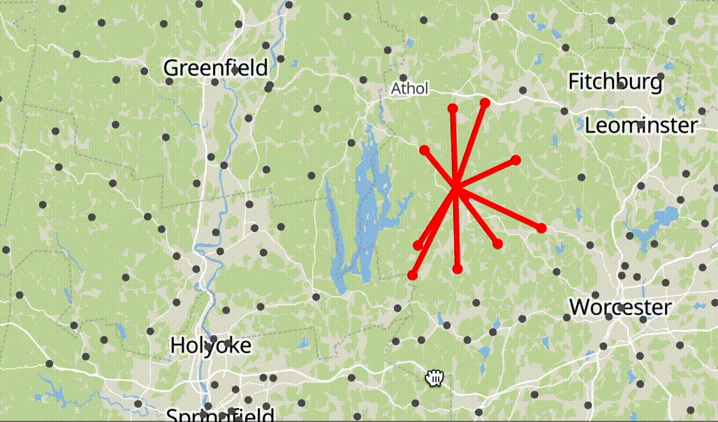
A map spider of Massachusetts libraries
On Twitter last week, we saw a fun visualization of airports that looked like a spider crawling across Europe. We love playing around with source map technology, so we put together a new version of the same map using Massachusetts library locations instead of airports. Visit the interactive to make your own spider crawling across Massachusetts, or remix the code yourself on Glitch.
The Leventhal Map & Education Center is an independent nonprofit. We rely on the contributions of donors like you to support our mission of preserving the past and advancing the future of maps and geography.
View this email in your browser
Leventhal Map & Education Center at the Boston Public Library
617.859.2387 · info@leventhalmap.org
{{SenderInfoLine}}