As part of a wider push towards statewide environmental regulation, the Areas of Critical Environmental Concern (ACEC) program was established in 1975 to identify and manage places that were deemed both important and at-risk. In this 1993 map, 22 ACECs are marked by red dashed polygons, including the Hinsdale Flats Watershed in western Massachusetts, the Westboro Cedar Swamp, and the Rumney Marshes that straddle Revere and Lynn. Today, eight additional ACECs and over 100,000 acres have been added via the nomination process, including Pope John Paul II Park, a 66-acre green space located in the Neponset River Estuary ACEC and located on a former landfill.
As the map notes in the supplementary text, areas that qualify as an ACEC must contain a “resource complex” that includes at least four of ten features from the given list:
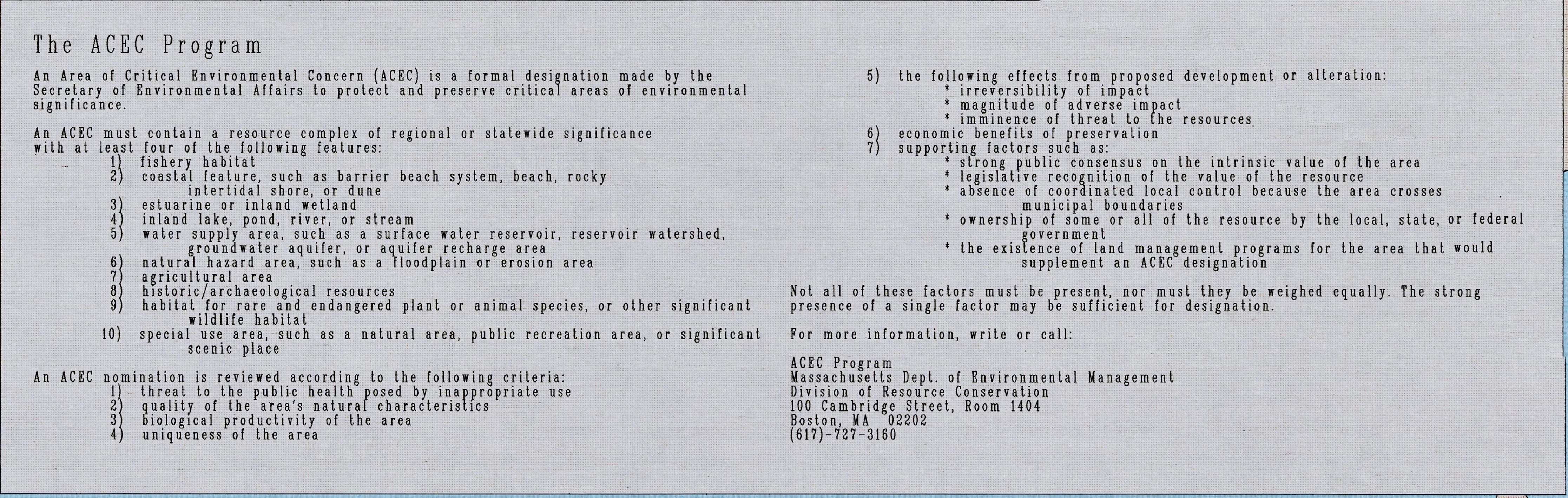
Identifying whether an area meets a certain set of predetermined criteria is called suitability analysis, and remains a common process for asking and answering all kinds of spatial questions. Computers are well-suited to applying hierarchy and order to slippery, chaotic phenomena. This can be useful, for example, when you need to locate ACECs and apply protective measures to them—but designating some landscapes as areas of “critical concern,” as the ACEC map and program do, can also lead to ignoring others.