Also produced in the late 1980s, these maps of Auburn and Millbury depict a buffer workflow that evaluates potential contamination in areas surrounding water wellheads. In this case, the geographic information systems (GIS) analysts took two kinds of features as an input: first, public water supply wells, and second, surface water bodies, like Eddy Pond. The resulting “Zone II” buffers represent a protective radius that restricts certain human activities, such as the above-ground storage of hazardous material, that could adversely affect the public water supply.
Around this time, people also started writing computer software that helped match textual descriptions of addresses to their real-world geographic locations. In the top-right hand corner of this map of Auburn, the authors describe their process for “address matching” underground storage tanks:
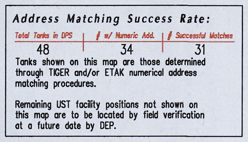
The two address matching programs they used—one from the U.S. Census’ TIGER, and the other from Etak, a company whose innovative navigation system is featured in the section on Calculating Routes"—would compare the address associated with each storage tank and try to find a match inside a larger database of street addresses. Today, address matching is more commonly known as geocoding and it happens behind the scenes every time you search for an address on your favorite map app.