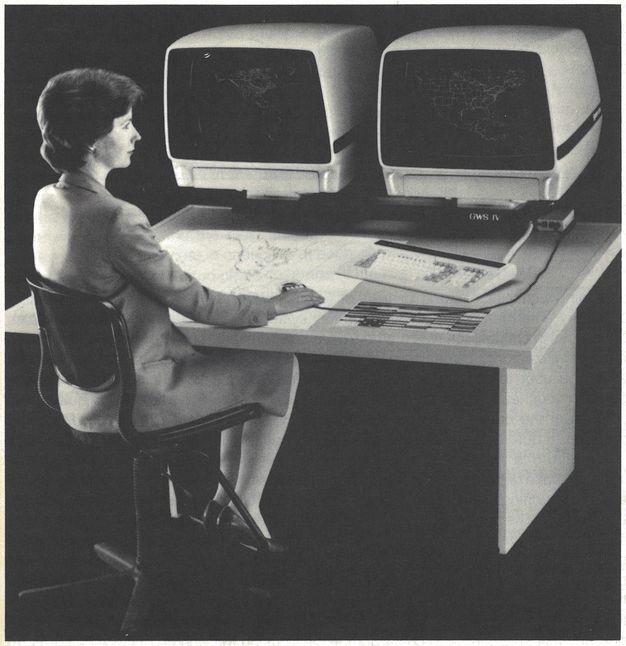
In the late twentieth century, cartographers, architects, and engineers commonly used digitizing pucks like this one to create geospatial data. Holding the digitizing puck much like a computer mouse, the operator would create points by tracing the puck across map features and pressing the numbered buttons to mark specific points as they passed through the puck’s crosshairs. Geographic information systems (GIS) software could then interpret and display this information as points, lines, and polygons in a computer map. The photograph below shows the process of how someone would use a digitizing puck when tracing an existing map or aerial image.