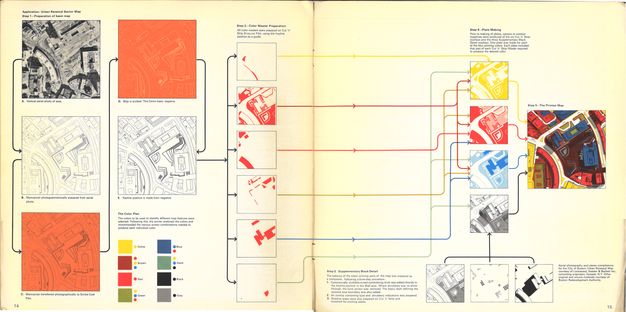
In this site plan, created by the Boston Redevelopment Authority (BRA) in 1968, color becomes political. Between the late 1950s and early 1970s, the BRA made hundreds of these urban renewal maps for various redevelopment projects in Boston. These projects were often fraught, as they tended to target lower-income and nonwhite neighborhoods, displacing the people who lived in them. With the right colors, however, urban renewal could look more welcoming—and the company that sold scribe films to the BRA understood this point. In the promotional booklet shown below, the drafting company Keuffel & Esser write, “The point is, a multi-color map—imaginatively conceived and skillfully produced—gains a graphic impact important to the selling function. It moves beyond the simple purpose of orientation and becomes a marketing tool.” In this case, the methods of map production can be directly traced to transformative (and even destructive) urban policies.