On August 29, we hosted From The Vault: Blue(print) Maps.
During the same time period that printers in China were producing the outstanding “blue maps” of Heaven and Earth currently on display in our gallery using a technique involving the pigment Prussian Blue, surveyors and other map makers in the West were producing their own “blue maps.” Based on the blueprint process introduced in the 1840s, these white-on-blue drawings could be produced rapidly and inexpensively while ensuring the longevity and accuracy of a reproduction, which greatly impacted the distribution of visual information.
This From the Vault featured examples from the Center’s survey collections that demonstrate how blueprints helped influence the changing 19th-century American landscape, from the fill of Boston’s Back Bay to a “celestial map” of Canton, Massachusetts to a railroad project in Texas.
These maps are not a part of our digital collections and the pictures of each object were taken during from the event. We’ve done our best to accurately portray each item, but for the best viewing experience, please schedule a research visit to the Center to see them in person.
Frederic Endicott Plan for Arc Lights. Canton, Mass. (1886)
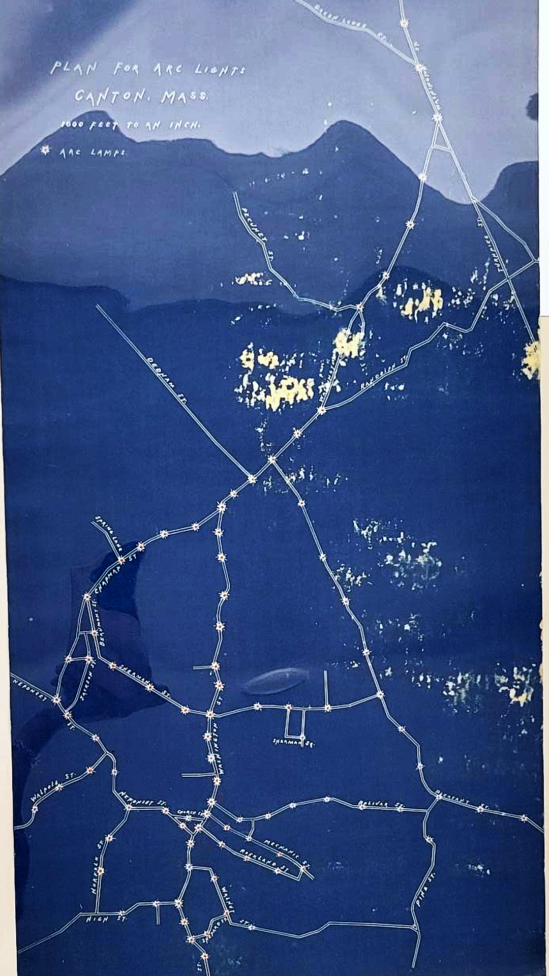
Introduced in the late 1870s, arc lamps were the primary technology used for street lighting until incandescent lamps took over in the early 20th century. In 1890, the town of Canton, Massachusetts installed its first set of street lights as a trial; within a few months, the lights were deemed indispensable and residents were demanding even more streets to be illuminated. In 1886, surveyor Frederic Endicott produced plans showing the locations of arc lights along the town’s major roadways. The minimalist presentation and the star-like symbol chosen to represent the lights evoke a celestial map such as those shown in the gallery exhibition, Heaven & Earth.
Fuller & Whitney Plans Commonwealth and Beacon (1880s)
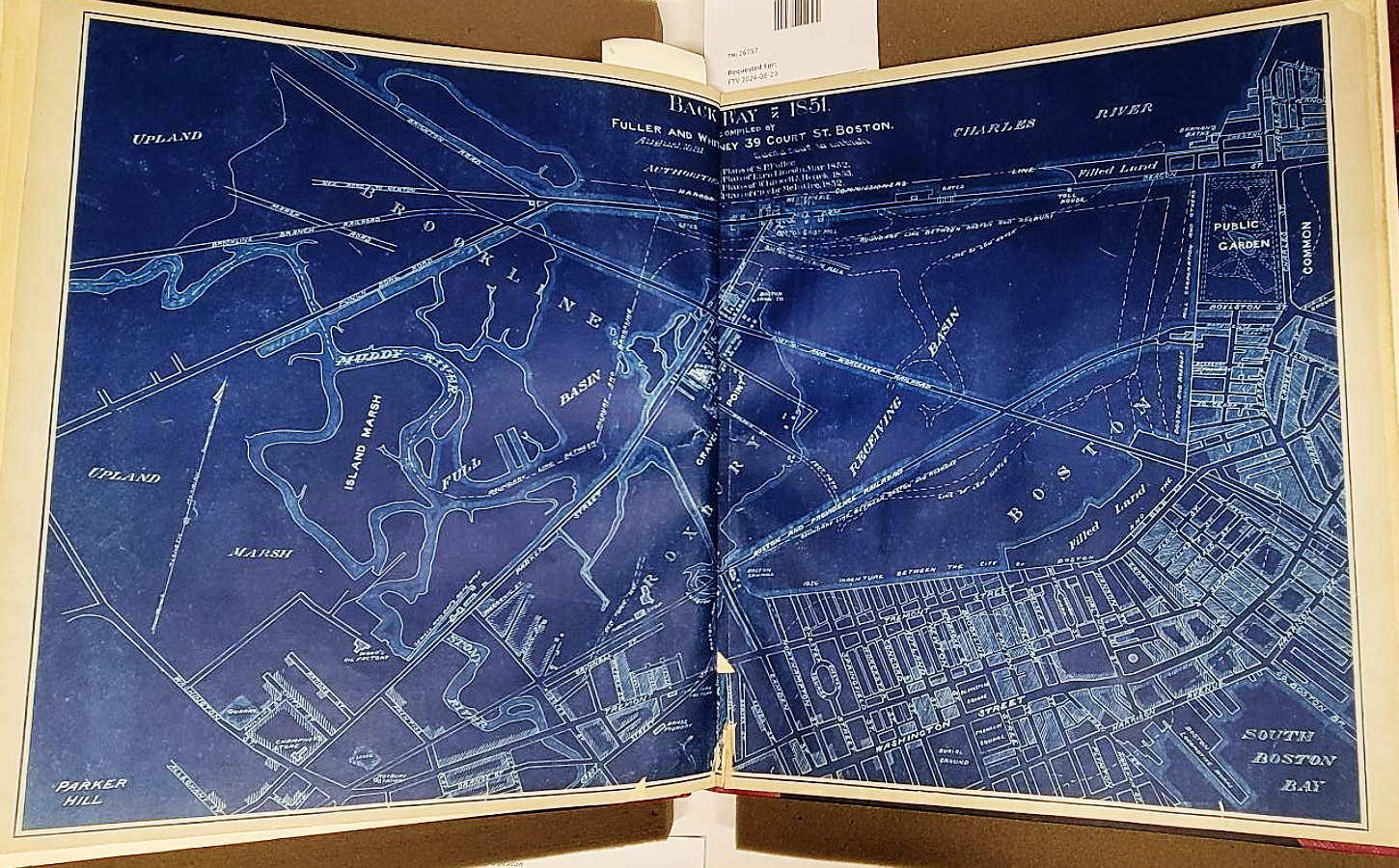
The civil engineering/surveying firm of Fuller & Whitney, later William H. Whitney, oversaw the development and filling-in of Boston’s Back Bay during the 1880s. This work involved the development of overall street layouts, studies of alternative schemes for various neighborhoods, and documentation of land sales. Most of these documents were circulated as blueprints, using a variant on the process invented in 1842 by Sir John Hershel that Whitney modified, earning him an award from the Massachusetts Charitable Mechanics' Association. His work in this area helped mainstream blueprints in his profession.
The treatment of the outlines of bodies of water in Back Bay evokes thoughts of some of the geographical maps in the current Heaven & Earth exhibit.
Louis Day Map - B. Property at Floral Park. Nassau County, N.Y. The Floral Park Corporation. (1919)
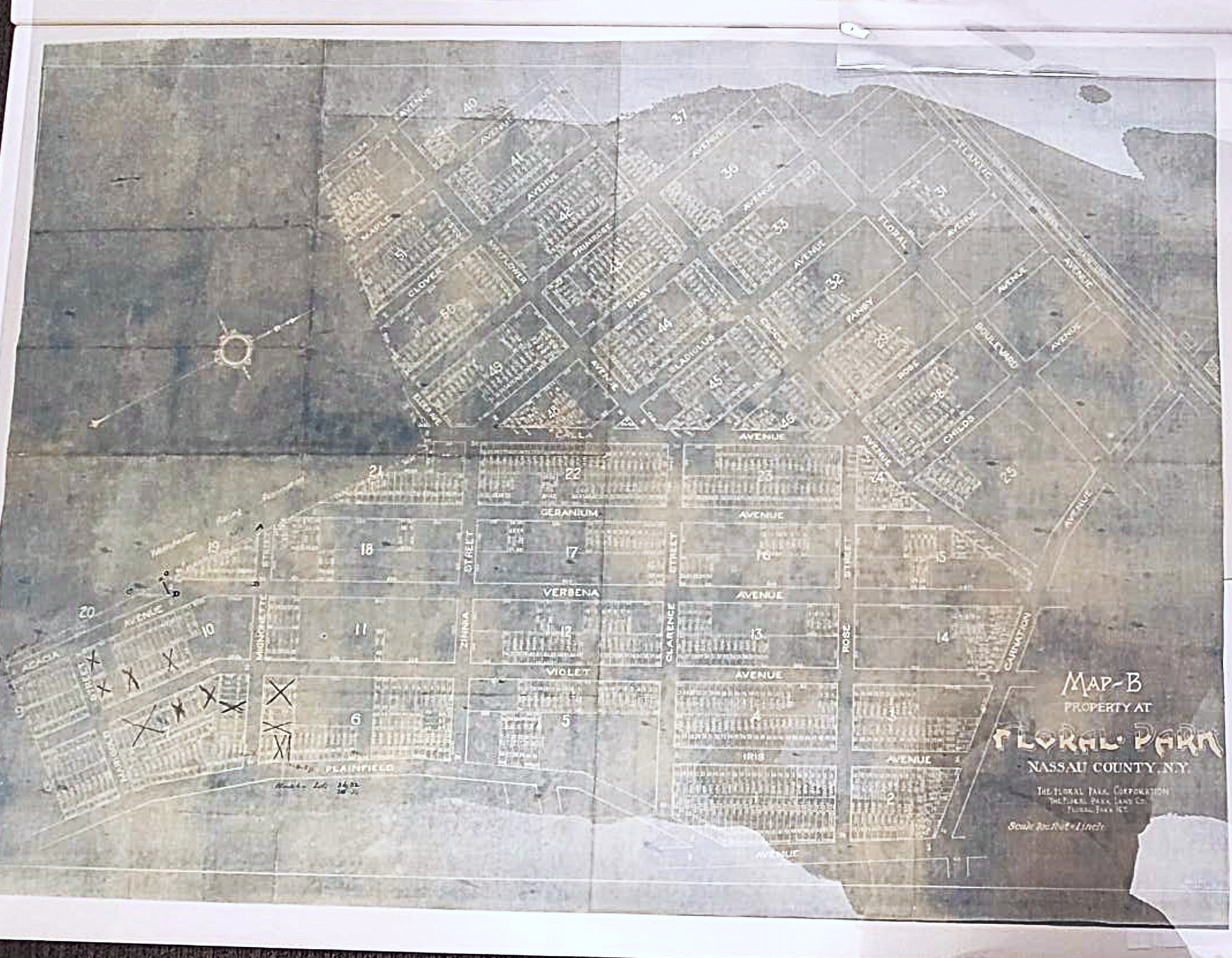
Floral Park in Nassau County, New York is an example of the late 19th-century interest in planned suburban communities, often supported by a conveniently nearby railway station. Based in a region of flower farms, the community features streets named after plants as well as many amenities. Development commenced in the 1880s and 1890s but additions continued well into the 20th century. Blueprints provided a useful format for the developers and planners to track modifications, lots sales, and other developments on copies of the original; this version shows crosses, probably to mark transactions related to specific lots.
C.R.B.; Edmund S. Davis Detail Plan. Section 4. Boylston Street Subway. Typical Cross Section. (1913)
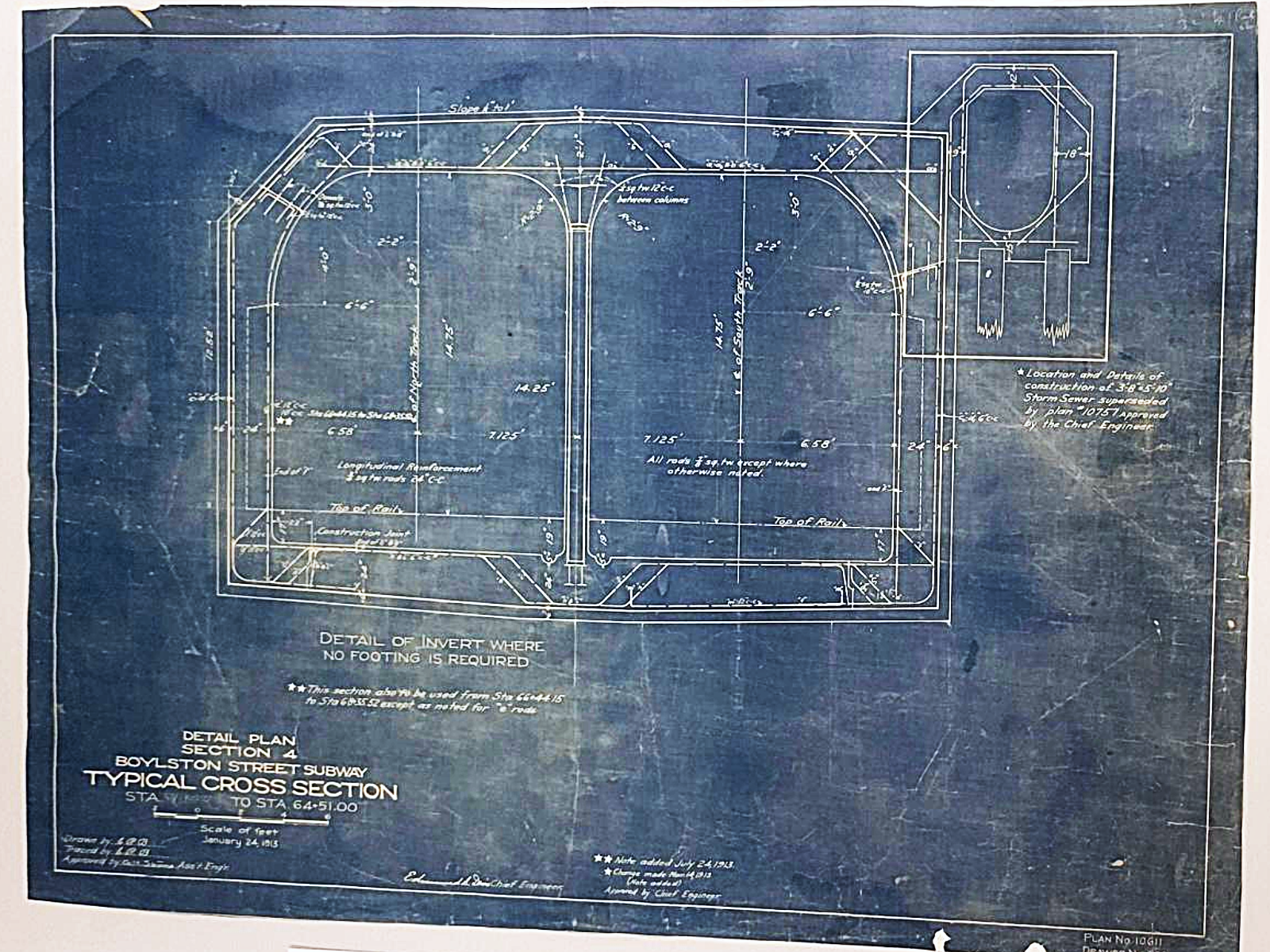
Since their introduction, blueprints have become synonymous with construction drawings. They are durable enough for use at construction sites, can be drawn on, and easily reproduced and distributed to the many trades involved in a construction project. This detailed plan shows a section elevation view of the subway tunnels at the MBTA Green Line Boylston Street subway station (the section clarifies how tight the space is between the two subway tracks). The creator was Edmund S. Davis, who served as chief engineer of the Boston Transit Department from 1909 through 1920.
Robert B. Bellamy Plan of Property of Society Har Moriah Cemetery Corporation, Hyde Park and West Roxbury Mass (1931)
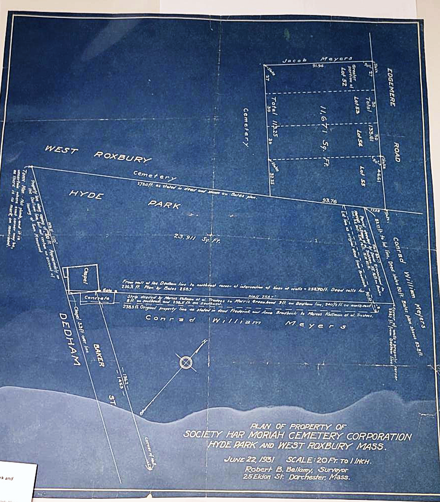
In 1931, Dorchester-based surveyor Robert B. Bellamy produced a survey for the Society Har Moriah Cemetery Corporation. The plan shows multiple lots at the Cemetery’s site at the Hyde Park / West Roxbury border. These two versions of the plan demonstrate the blueprint process – the image on the left is the original drawing, created with dark ink on a translucent paper. The blueprint process produced a reverse image of white lines and text on a blue background. An infinite number of prints could be produced in much less time than hand copying and the prints could be marked up, rolled, and otherwise handled without impacting the original. The prints also were difficult to modify without being obvious so they often served as “record copies.”
Frederic Endicott Map of Three Mile Island in Lake Winnipesaukee Owned by the Appalachian Mountain Club. Together with its Nearest Neighbors. (1902)
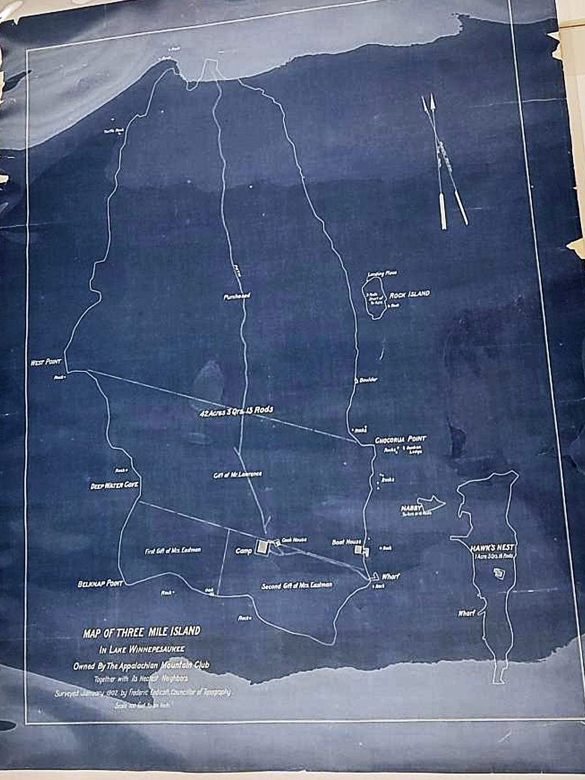
Surveyor Frederic Endicott loved mountaineering and was an active member of the Appalachian Mountain Club (AMC) where he assumed various roles, including “Councilor of Topography” (the AMC also has his photography collection). In the 1900s, the area around Lake Winnipesaukee was remote and undeveloped; Endicott helped in documenting the transfer of lots on the lake’s Three Mile Island owned by Mrs. Eastman and Mr. Lawrence to the Club. Today, the island is a highly popular resort for camping.
Map of the Pan American R.R. and its connections.
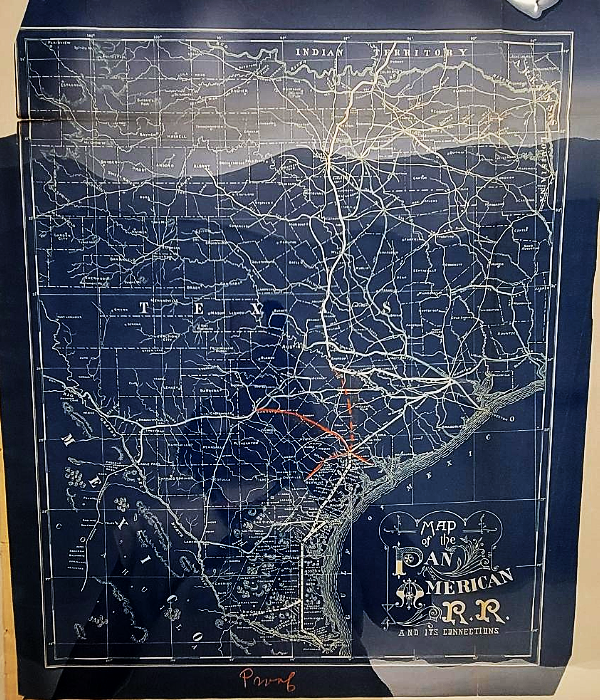
The Pan American R.R. was started in 1891 by a group of Boston investors who sought to build a railroad line from Victoria, Texas to Rio de Janeiro, Brazil. The decorative title block suggests that this map was designed to interest potential investors. However, the railroad never took off – only 10 miles of track were completed before the investors ran out of money. The map displays the proposed route in the context of other railroad lines in Texas. This print shows a standard mode of editing prints – a red pencil.
Viaux, F. H.; Whitney, William H. Suggestions for the Laying Out of the Lands of the Charles River Embankment Co. and Others. (1888)
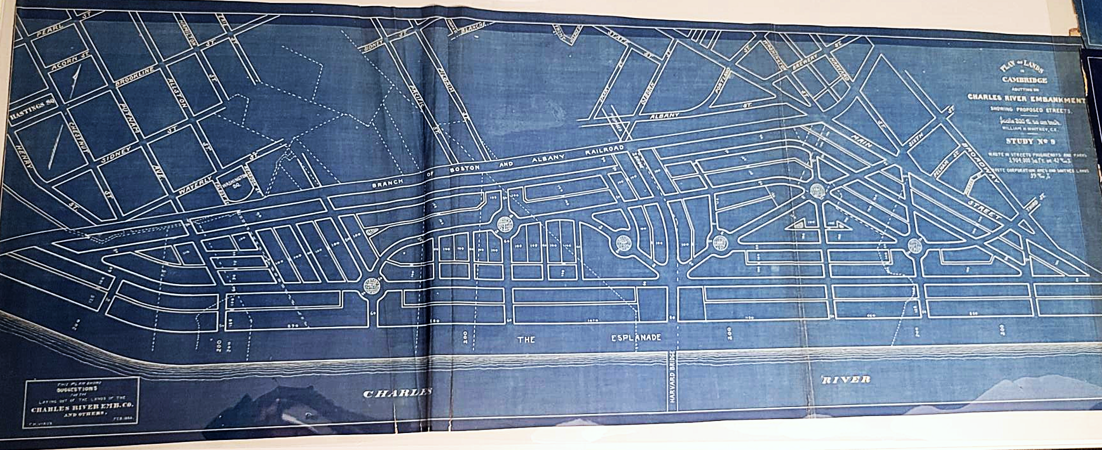
In the 1880s and 1890s, the rapid development of the Back Bay on the Boston side of the Charles River excited land developers about the possibilities of mirroring the Back Bay on the Cambridge side. One such project was proposed by Charles Davenport of the Charles River Embankment Company. Inspired by a visit to Havana, Cuba, Davenport hired Frederick H. Viaux to design a series of studies for a new residential neighborhood on what had largely been swamp land. This design featured an esplanade fronting roads and blocks with multiple rotaries. This particular project never came to fruition – the developer went bankrupt – and the neighborhood lay dormant for a time until M.I.T. moved there from Back Bay in the 1910s and developed its current campus alongside what is now Memorial Drive.
Our articles are always free
You’ll never hit a paywall or be asked to subscribe to read our free articles. No matter who you are, our articles are free to read—in class, at home, on the train, or wherever you like. In fact, you can even reuse them under a Creative Commons CC BY-ND 2.0 license.