Over the course of a semester, a small group of juniors and seniors in the Maptivist elective course explored the question how do racial ideas become spatial practice in Boston? with educators from the Leventhal Map & Education Center team. After an introductory set of activities, readings and guest speakers, students chose three topics to look at more closely:
- segregation and integration by economics and choice
- police violence and protest
- connecting across racial lines
For their final projects, students learned to make their own data maps in ArcGIS, find and interpret additional maps, explore related resources, and interview someone with some kind of knowledge or expertise on the topics. They presented what they learned in Esri StoryMaps and in presentations to each other and to invited visitors.

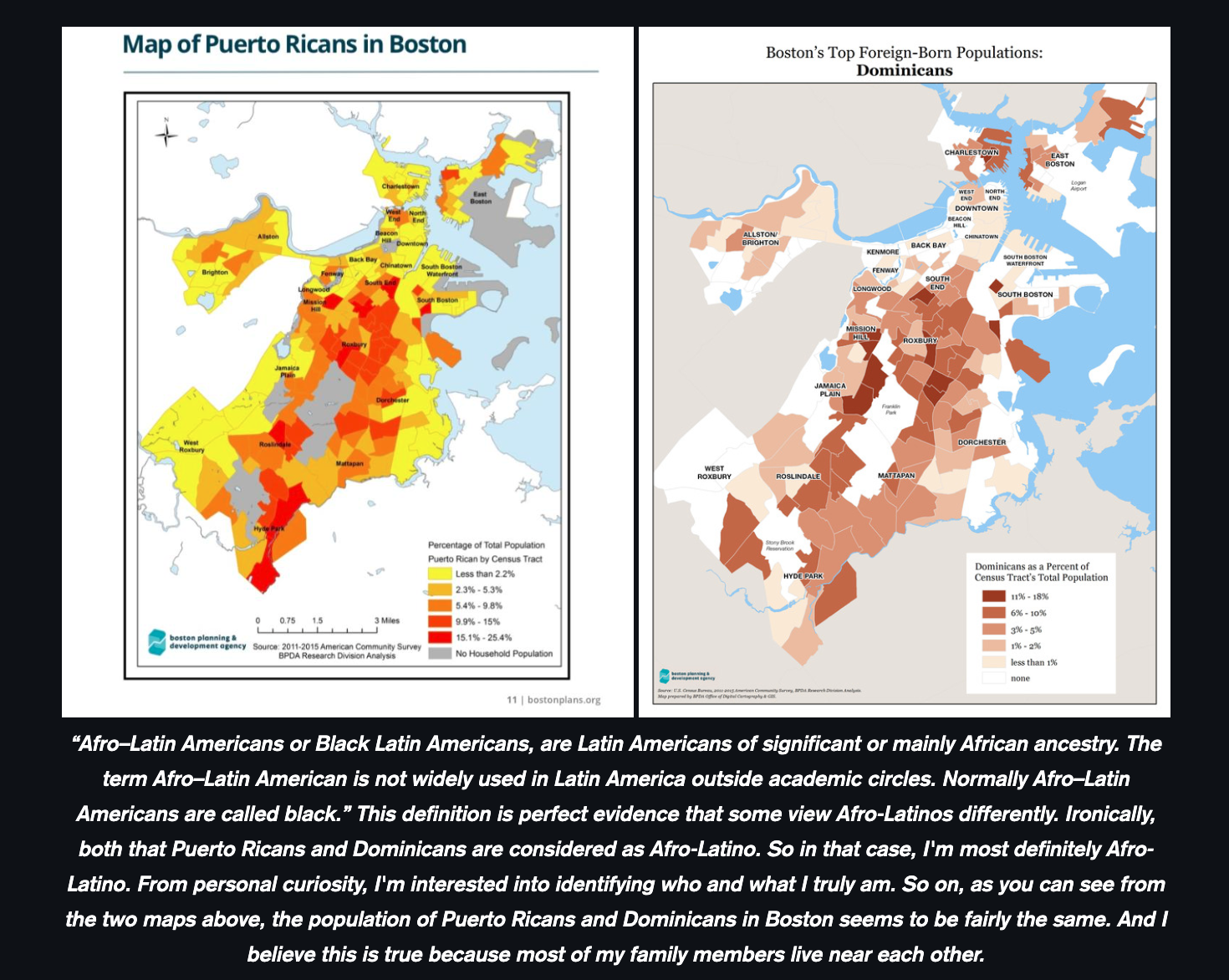
The projects included an investigation into the representation of Afro-Latinx identity in data and on maps, or the absence of it, and changes in racial diversity in Boston Public Schools over time and between schools and the many factors in play behind the statistics. In their final evaluations, students expressed enjoying learning about history, like redlining and diversity. They found it wasn’t hard to make maps but that it was important that maps showed “correct” information. They also appreciated thinking about their own identities and how there are many diverse perspectives on the struggles facing Boston residents.

The K-12 team will be reflecting on the first iteration of the class over the summer, thinking about how best to share what they learned with more educators and students moving forward.
Our articles are always free
You’ll never hit a paywall or be asked to subscribe to read our free articles. No matter who you are, our articles are free to read—in class, at home, on the train, or wherever you like. In fact, you can even reuse them under a Creative Commons CC BY-ND 2.0 license.