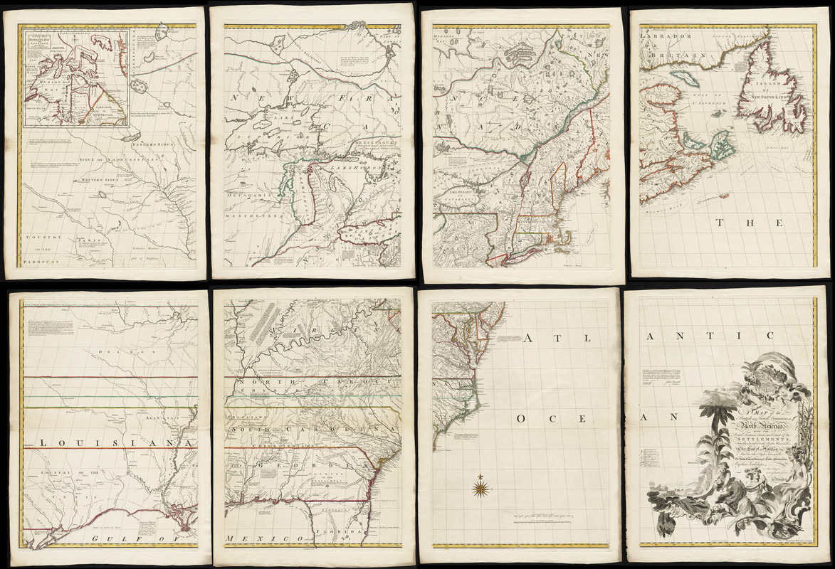
A map of the British and French dominions in North America with the roads, distances, limits, and extent of the settlements, humbly inscribed to the Right Honourable the Earl of Halifax, and the other Right Honourable the Lords Commissioners for Trade & Plantations
This map is also available in American Revolutionary Geographies Online (ARGO), a collections portal especially built for material relating to the American Revolutionary War Era. Visit ARGO to learn more about this item and explore the historical geography of North America in the late eighteenth century.
Item Information
- Title:
- A map of the British and French dominions in North America with the roads, distances, limits, and extent of the settlements, humbly inscribed to the Right Honourable the Earl of Halifax, and the other Right Honourable the Lords Commissioners for Trade & Plantations
- Creator:
- Mitchell, John, 1711-1768
- Engraver:
- Kitchin, Thomas, d. 1784
- Contributor:
- Millar, Andrew, 1707-1768
- Name on Item:
-
by their Lordships most obliged and very humble servant, Jno. Mitchell ; Tho: Kitchin, sculp.
- Date:
-
1755
- Format:
-
Maps/Atlases
- Location:
- George Washington's Mount Vernon
- Collection (local):
-
Richard H. Brown Revolutionary War Map Collection at Mount Vernon
- Subjects:
-
North America--Maps--Early works to 1800
- Places:
-
North America (area)
- Extent:
- 1 map on 8 sheets : hand col. ; 136 x 195 cm, sheets 76 x 55 cm.
- Terms of Use:
-
No known copyright restrictions.
This work is licensed for use under a Creative Commons Attribution Non-Commercial Share Alike License (CC BY-NC-SA).

- Publisher:
-
[London] :
Sold by And: Millar opposite Katharine Street in the Strand
- Scale:
-
Scale [ca. 1:2,020,000]
- Language:
-
English
- Catalog Record:
-
MVLA record
- Notes:
-
Relief shown pictorially.
First English edition, 3rd impression.
Includes text and inset "A new map of Hudson's Bay and Labrador from the late survey of those coasts."
- Identifier:
-
06_01_008540


