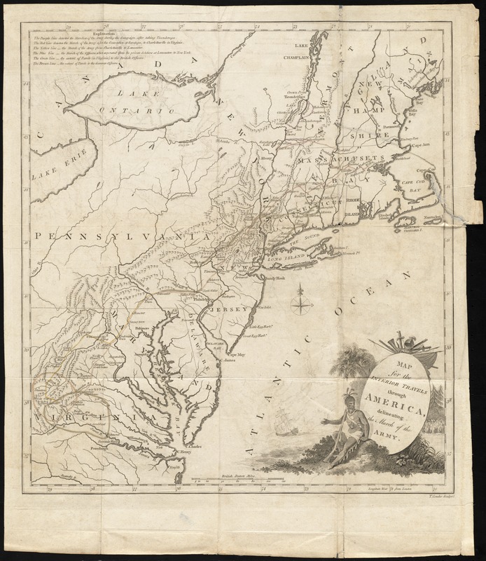
Map for the interior travels through America : delineating the march of the army
This map is also available in American Revolutionary Geographies Online (ARGO), a collections portal especially built for material relating to the American Revolutionary War Era. Visit ARGO to learn more about this item and explore the historical geography of North America in the late eighteenth century.
Item Information
- Title:
- Map for the interior travels through America : delineating the march of the army
- Engraver:
- Conder, Thomas, 1746 or 1747-1831
- Contributor:
- Anburey, Thomas
- Publisher:
- Lane, William, -1814
- Name on Item:
-
T. Conder sculpsit.
- Date:
-
[1789]
- Format:
-
Maps/Atlases
- Location:
- Boston Athenaeum
- Collection (local):
-
Cartographic Collection
- Subjects:
-
United States--History--Revolution, 1775-1783--Maps--Early works to 1800
United States--Maps--Early works to 1800
Maps--United States--1780-1790
- Places:
-
- Extent:
- 1 map : color ; 39 x 35 cm., on sheet 47 x 41 cm.
- Terms of Use:
-
Collection of the Boston Athenaeum. May not be reproduced or quoted without written permission. For more information, see http://www.bostonathenaeum.org/node/46
Contact host institution for more information.
- Publisher:
-
[London, England] :
[W. Lane]
- Scale:
-
Scale approximately [1:2,500,000]
- Language:
-
English
- Catalog Record:
-
http://catalog.bostonathenaeum.org/vwebv/holdingsInfo?bibId=507543
- Notes:
-
Relief shown pictorially.
Prime meridian: London.
Detached from: Anburey, T. Travels through the interior parts of America. London [England] : Printed for W. Lane, 1789.
- Notes (date):
-
This date is inferred.
- Notes (object):
-
Hand colored. Designed to be colored in 6 colors.
Key to color coding at upper left.
- Barcode:
-
31807008479678


