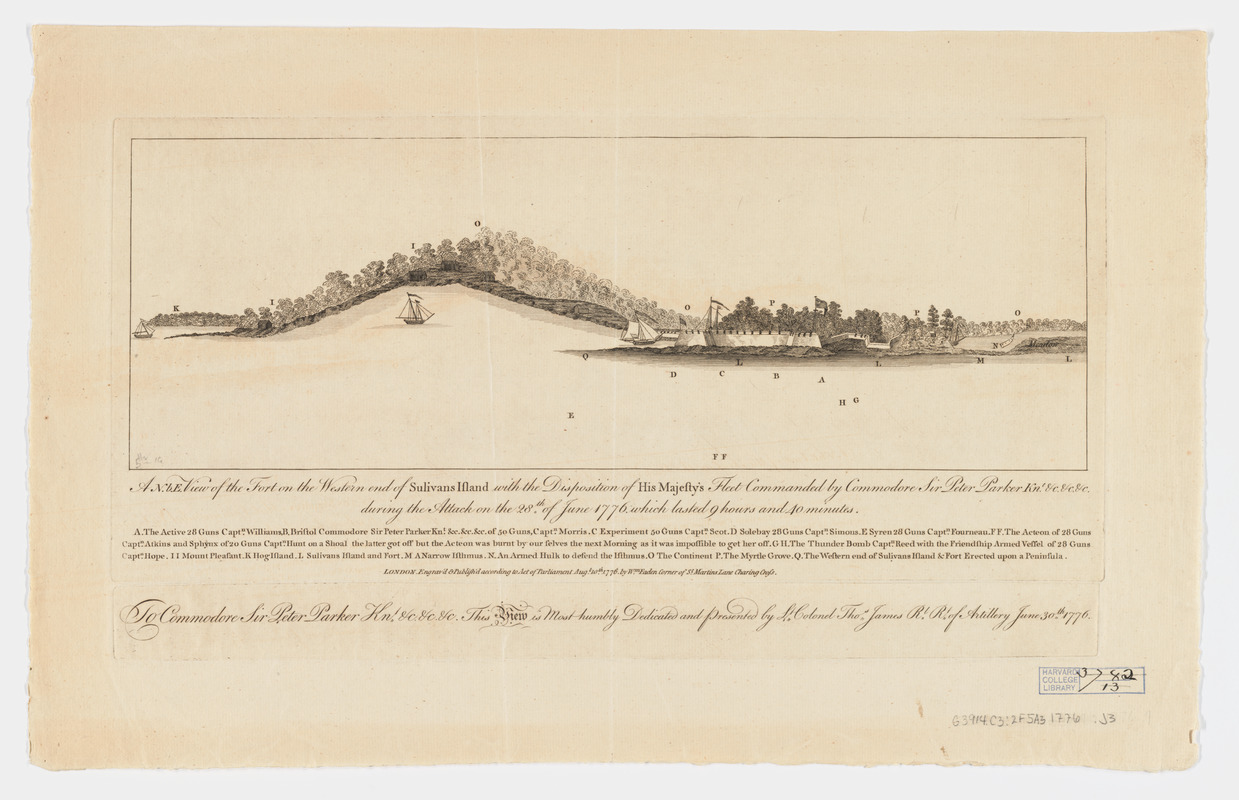
A N.b.E. view of the fort on the western end of Sulivans Island : with the disposition of His Majesty's fleet commanded by Commodore Sir Peter Parker Knt. & c & c & c during the attack on the 28th of June 1776, which lasted 9 hours and 40 minutes
This map is also available in American Revolutionary Geographies Online (ARGO), a collections portal especially built for material relating to the American Revolutionary War Era. Visit ARGO to learn more about this item and explore the historical geography of North America in the late eighteenth century.
Item Information
- Title:
- A N.b.E. view of the fort on the western end of Sulivans Island : with the disposition of His Majesty's fleet commanded by Commodore Sir Peter Parker Knt. & c & c & c during the attack on the 28th of June 1776, which lasted 9 hours and 40 minutes
- Title (alt.):
-
North by east view of the fort on the western end of Sulivans Island
View of the fort on the western end of Sulivans Island
- Creator:
- James, Thomas, -1782
- Contributor:
- Faden, William, 1749-1836
- Date:
-
1776
- Format:
-
Prints
- Genre:
-
Views
- Location:
- Harvard Library
- Collection (local):
-
Harvard Map Collection
- Subjects:
-
Sullivans Island (S.C.)--Pictorial works
Revolution, 1775-1783
1775–1783
- Places:
-
South CarolinaCharleston (county)Sullivan's Island (island)Sullivans Island
- Extent:
- 1 view ; 14 x 41 cm., on sheet 31 x 50 cm.
- Terms of Use:
-
No known copyright restrictions.
This work is licensed for use under a Creative Commons Attribution Non-Commercial Share Alike License (CC BY-NC-SA).

- Publisher:
-
London :
Engav'd & Publish'd according to Act of Parliament ... by Wm. Faden
- Scale:
-
Not drawn to scale
- Language:
-
English
- Catalog Record:
-
http://id.lib.harvard.edu/aleph/010136205/catalog
- Notes:
-
Dedication: To Commodore Sir Peter Parker, kn.t &c. &c. &c. This view is most humbly dedicated and presented by Lt. Colonel Thos. James Rl. Rt. of Artillery, Five Fathom Hole South Carolina, June 30th 1776.
Includes detailed index.